|
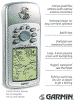
Handheld GPS
Click any picture to expand
 I
always use the NOAA and Canadian CHS charts as my primary navigation tool.
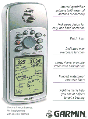
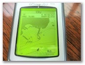
However, the Garmin GPSMAP
76S handheld GPS is a valuable navigation adjunct. I
always use the NOAA and Canadian CHS charts as my primary navigation tool.
However, the Garmin GPSMAP
76S handheld GPS is a valuable navigation adjunct.
This is an amazing piece of technology. It took
me about a year before I was really comfortable with it. There are several
versions of the 76 series including at least two new color versions (GPSMAP
76CX). These latter models have greater memory and longer battery
life. Check out the Garmin
Website for more information on the various models.
This is one case where careful analysis of
your requirements is essential because you really do get what you pay for. If
your memory needs are modest, or you don't need all the bells and whistles, go
with the cheapest version you can find; but remember the biggest difference
between the models is memory and features.
There a several other good handhelds from
Magellan and others but I think you'll find that the Garmin 76 gets a lot of
kudo's in the archives of this forum. There are a number of G76 versions, so
look at each carefully and match to your requirements. Practical sailor recently
did a review on handhelds and gave the 76 series top marks. Fits in the pocket
nicely. West Marine has a G76 version that gets PS's #1 recommendation.
The "Plain Jane 76" has only 1 MG of
memory while the 76CS has 115MG. In addition, the more expensive GPSMAP76S
has a barometer, altimeter, tide tables, alarms, phases of the moon, best
fishing times, and electronic compass. If you want to download charts or need to
know when and where the thin water is, the more expensive unit might be a better
buy.
Selling prices vary widely. I got mine
from GPSnow.com which has
an incredible amount of information on GPS units of all types. You might find a
bargain on one of the older, but very capable models.
 I
believe all the G76 models have the same basemap which have NAVAID info for
North and South America, major highways, thoroughfares, rivers, lakes, and
borders; however, the GPSMAP
76S has more memory (24 MB) for downloading MapSource® digital charts. It's
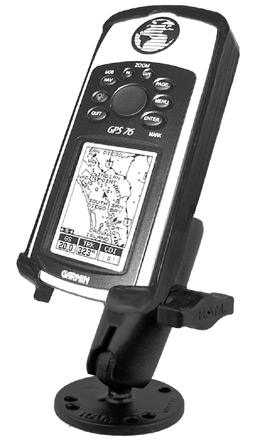
also waterproof and floats. I've dropped my unit a number of times and it's
still ticking. On the otherhand, the stock GPS mount from Garmin
shown here is expensive and flimsy. I
believe all the G76 models have the same basemap which have NAVAID info for
North and South America, major highways, thoroughfares, rivers, lakes, and
borders; however, the GPSMAP
76S has more memory (24 MB) for downloading MapSource® digital charts. It's
also waterproof and floats. I've dropped my unit a number of times and it's
still ticking. On the otherhand, the stock GPS mount from Garmin
shown here is expensive and flimsy.
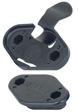
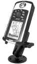 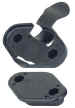 RAM
makes a much better mount for about the same price. Search the internet for
RAM-B-138-GA6U mount and the RAP-326 Ezy-mount quick release adapter. RAM
makes a much better mount for about the same price. Search the internet for
RAM-B-138-GA6U mount and the RAP-326 Ezy-mount quick release adapter.
For most local sailing, the ability to download
digital charts is probably not necessary -- knowing the Lat & Long and a
good chart is sufficient. That said, knowing at a glance how close you are to
the entrance of the harbor in a heavy fog is worth a lot of money.
I did purchase the Blue Chart CD for Lakes
Michigan and Huron and up loaded them to the unit. I did not purchase the
Florida CD because our trip to Key West this Spring was a one time thing. This
was a good decision because the basemap had every NAVAID on the NOAA charts for
Key West and we got along just fine.
It is theoretically possible to scan a NOAA chart
and display a Raster chart on a PC or GPS (Chart1); however, you won't find this
level of detail on your screen because this takes up a lot of computing power.
The GPS and the BlueChart CD display Vector charts that have less detail (Chart
2 & 3) but have all the important info you'll need.
As long has you use the NOAA/CHS paper charts as
your primary navigation source, Vector charts work fine. Any GPS will give you
pretty precise info on where you are; however, you can use the MapSource
software to plan your trips and keep a record of your actual track. Here's some
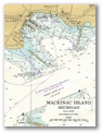
comparisons of the different digital chart types of NOAA chart 14881, Mackinac
harbor.
|
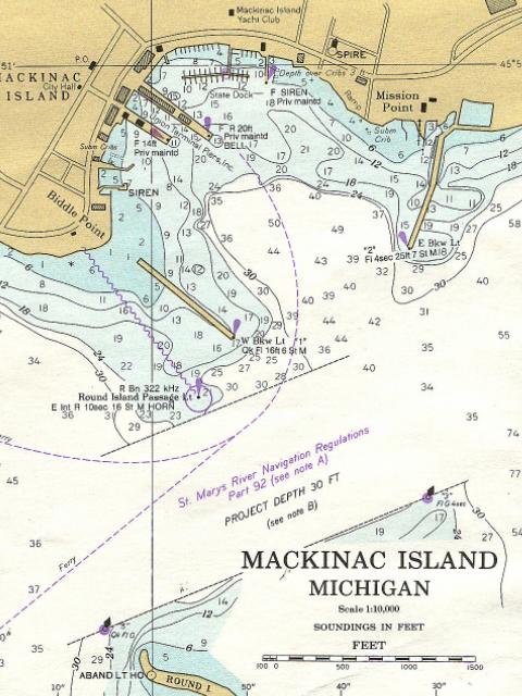
Mackinac Harbor, MI
NOAA Chart 14881
Click to expand any chart |
|
|
|
|
Chart
1
Bitmap scan
NOAA 14881 |
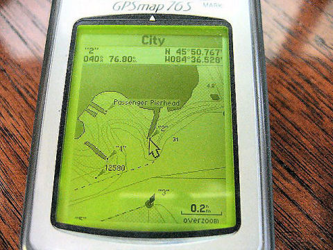
Chart
2
GPSmap76S
Vector Chart
Screen |
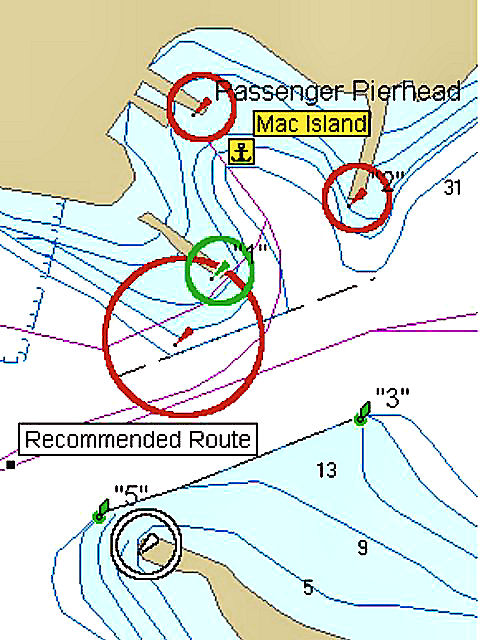
Chart
3
BlueChart
PC Vector Chart
screen |
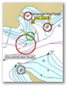
The bitmap scan (Chart 1) is
an exact digital copy of Mackinaw Harbor in NOAA chart 14881. The center
photo (Chart 2) is the
vector chart display on the G76S, (Chart 3)
is a Vector chart from my PC screen. If you want to know the technical
differences between the different types of formats go to gpsinformation.net;
you'll get all you ever want to know about GPS formats, models and
capabilities.
One nice
feature of the MapSource® BlueChart software is the ability to plan your trips
on your PC at home or take a laptop with you on the boat. After I plan my
trip, I use the software to print out my route in table form. Click
here for examples:
The G76 also leaves "breadcrumbs" or
tracks so you can retrace your trip or race at a later time. Here's some
examples of Vector charts with the actual tracks from our North Channel trip as
they appear on the PC Screen. Click here for more examples
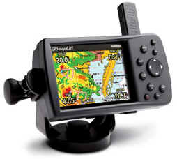
 Other
options: A little larger and quite a bit more expensive are the G276/376 and
the G378/478 series. Really, nice. Not as portable as my G76, but I'm still
hoping Santa will take the hint this year and bring me one. Go to the Garmin
website for more information on these models. Other
options: A little larger and quite a bit more expensive are the G276/376 and
the G378/478 series. Really, nice. Not as portable as my G76, but I'm still
hoping Santa will take the hint this year and bring me one. Go to the Garmin
website for more information on these models.
|